|
LAFOURCHE PARISH GAME AND FISH COMMISSION
Preserve Description
| ||
|
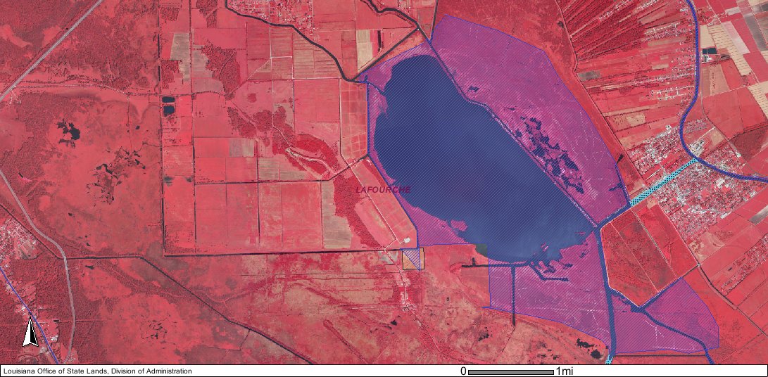
The Lake Field/Lake Long Game and Fish Preserve (Preserve) includes approximately 3,060 acres around Lake Fields and 3,625 acres around Lake Long
and is located in Lafourche Parish south of U.S. Highway 90, west of the Town of Lockport, and north of the Gulf Intracoastal Waterway. The embedded Bing web site
map viewer can be used to display the Lake Fields and Lake Long area. If you choose to move to the Bing web site, the "birds-eye view" is
highly recommended for close ups.
The Preserve boundaries coincides with the high water marks or 1857 historic meander lines of Lake Fields and Lake Long except for some areas that have been sold or transferred by the State of Louisiana. The official state lands map comprising the Preserve can be downloaded and viewed. In, addition, maps of the state lands surrounding Lake Fields and Lake Long are shown below.
For more detail and flexibility, the Preserve boundaries may also be viewed online through the Louisiana Department of Natural Resource Offices map viewer of Louisiana. To view the Preserve with the state land boundaries, the following is recommended:
The Lake Fields and Lake Long watershed of 52,214 acres originates just south of Thibodaux. The area is sparsely populated except for the Bayou Lafourche corridor. The drainage basin is 38.7% agriculture/cropland/grassland, 20% fresh marsh, 18.4% wetland forests, 9.4% urban, and 8.5% water, with the remainder miscellaneous forests or wetlands. Sources of freshwater for Lake Fields are from the Gulf Intracoastal Waterway and Bayou Lafourche via Company Canal and from the Bayou Folse watershed. Freshwater inflow into Lake Long originates from Company Canal, Hollywood Canal, and several oil exploration and canals. This inflow of freshwater, coupled with minimal daily tidal effects, generally produce year round freshwater conditions although periodic seasonal saltwater intrusion may occur from the south via Company Canal during periods of low rainfall and/or low Atchafalya River discharges. The Preserve is open to the public at all times for recreation and other legal activities. Recreational opportunities available in the Preserve include sport fishing, hunting (deer, waterfowl, and rabbits), boating, bird watching, frogging, and camping. Access is primarily from public boat launches along Company Canal in Bourg (Texas Gulf Road) and Lockport (Canal Street) and the Butch Hill launch on Bayou Cut Off (Highway 652). |